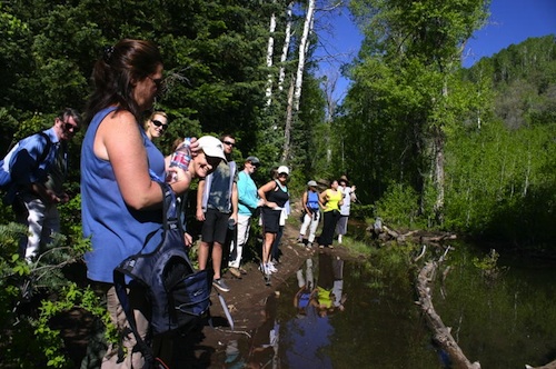
A quick drive and a short walk is all it takes to enjoy the best beginner hikes in Utah. We’ve discovered three hiking trails the whole family will enjoy.
Outdoor Enthusiast, Sheryl McGlochlin, shares her favorite beginner hikes.
· ALL hikers have to EARN their “hiking legs”! These trails will make it a lot of fun and not get you discouraged when you are just starting out!
· Most of these trails are not so isolated in the middle of the wilderness.
· Safety should always be your priority ANYTIME you are hiking.
· Avoid hiking alone.
· Bring 1.5 liters of water and drink often.
· Bring a camera since all of these hikes have spectacular views!
· Tell someone where you are going and when you plan to return.
· Be alert and courteous to others on the trail including dogs, mountain bikers and other hikers.
· Consult a physician before starting any new exercise program.
· Realize that hiking can be a dangerous sport.
· Use good common sense.
· Look for opportunities to meet others who love hiking.
· Get out there often and you’ll develop a true passion for this great sport!
· After a while, you forget hiking is actually a great workout!
· You’ll get caught up with all the amazing beauty that surrounds you!
Top 5 picks:
BST (Bonneville Shoreline Trail) (Current Trail: Ogden to Payson)
Location – Several places to access trail: http://www.bonnevilleshorelinetrail.org/
Highlights:
· Follows the old shoreline of Lake Bonneville
· Currently over 100 miles of trail
· Proposed trail will include 280 miles and reach from Idaho to Nephi!
· Sweeping views of mountain ranges, valleys, cities and the Great Salt Lake
· When you are ready for a harder hike, many trails intersect with the BST
· On many parts of the trail, dogs and mountain bikes are allowed on the trail besides hikers
· Much of this trail is single-track
· Great trail for winter snowshoe hiking
· Best time to hike: Spring, fall OR mornings before it gets warm
· Exposed to sun
· Very defined, well-used trail
Mormon Trail – (also known as California or Pony Express Trail) (Morgan County or Salt Lake County)
Location – Drive up Parleys Canyon, (I-80 EASTbound), approx. 5 miles up the canyon watch for the “East Canyon” exit, get off, drive approx. 3 more miles to Little Dell Reservoir, which is your first and closest opportunity to hike on this trail. This is one of several places you can access this trail.
Highlights:
· The actual Mormon Trail runs hundreds of miles
· This 9-mile section is the best for local hiking
· 9 Miles of pure beauty from Little Dell Reservoir to Mormon Flats
· Several places to access trail so hike as long as you like
· Single Track trail
· 7400 ft. highest elev. gain
· Lush, green beautiful trail
· Great trail for winter snowshoe hiking
· Very defined, well-used trail
· Trail split into two main sections:
· Mormon Flats to Big Mountain (approx. 4 miles one way)
· Big Mountain to Little Dell Reservoir (approx. 5 miles one way)
· Enjoy just one mile of this trail if you prefer!
Pipe Line Trail (Salt Lake County) (Millcreek Canyon):
Location – Easiest place to get on the trail: Birch Hollow trailhead: Drive 4.3 miles from mouth of canyon, .1 mile past Porter Fork, trail starts on left side, Mouth of Millcreek Canyon is located at 3800 So. Wasatch Blvd.
Highlights:
· Approx. 7 miles long (one way)
· Spectacular views of the
· Only 150 feet elevation gain during the entire 7 miles!
· Great trail for winter snowshoe hiking
· Best time to hike: Spring, fall OR mornings before it warms up
· Exposed to sun
· Just 15 minutes from downtown Salt Lake City
· Trailhead: 6600 ft.
· Sometimes you may be Walking next to a steep slope
· Very defined, well-used trail
· Dogs allowed
· Sweeping views of the entire canyon, Salt Lake valley, The Cove, and the Great Salt Lake
· Fee Station when you leave: $3/vehicle
Lost Prospector Trail (Park City) (Summit County)
Location – Best place to start: Arie Drive, only a few parking spaces near the trailhead OR for more
Highlights:
· 7.8 mile loop hike
· One of my favorite fall hikes due to so much color!
· Lots of foliage along the trail
· Incredible views of Park City including the Park City ski resort
· Elev. Gain: only 300 feet
· Hikers, mountain bikes,
· Double check before bringing your dog
Antelope Island State Park:
Location – (Davis County) Approximately 41 miles north of Salt Lake City. Take Exit 332 off Interstate 15, then drive west on Antelope Drive for 7 miles to the park entrance, then another 7 miles to the island.
Highlights:
· Be surrounded by the Great Salt Lake!
· Entrance Fee: $9/vehicle, discounts for seniors, pedestrians, cyclists
· Beautiful, peaceful, quiet
· Feels like you are FAR from civilization but really only 7 miles!
· Horse trails
· Dogs on leash allowed
· Lakeshore Trail
· 2.8 miles one way
· At times the trail may get rocky but it’s never hard
· Trail ends at Bridger Bay Campground
· Walk back to trailhead OR have someone pick you up at the campsite
· Elev. gain: 69 feet
· Buffalo sightings
· Lakeside Trail is another easy option
· Bring your camera! On a clear day you’ll experience breath-taking views of the Wasatch Mountain Range
Follow our adventures by joining our free Outdoor Adventure newsletter or
Join our Outdoor Adventure Group by visiting my website, Live and Thrive.com


Add comment